|
3D map of the reported top of the Permian Basin Wolfcamp formation. This
map illustrates how the Wolfcamp is divided by the
Central Platform into two halves. Note, the map is rotattable
and zoomable. |
Oil and Gas Overview Information for Selected Countries Approach Energy Presentation on the Wolfcamp formation. Are Permian Shales the Next Big Thing? Texas Railroad Commission Permian Basin Information EIA Permian Drilling Productivity Report |
Permian Basin: 3D Wolfcamp Structure Map with Select Well Results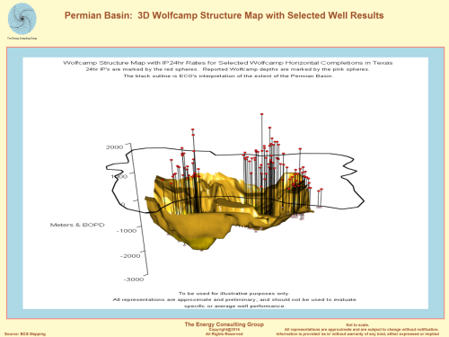 |
Permian Basin: 3D Wolfcamp Structure
Map Relative to the Surface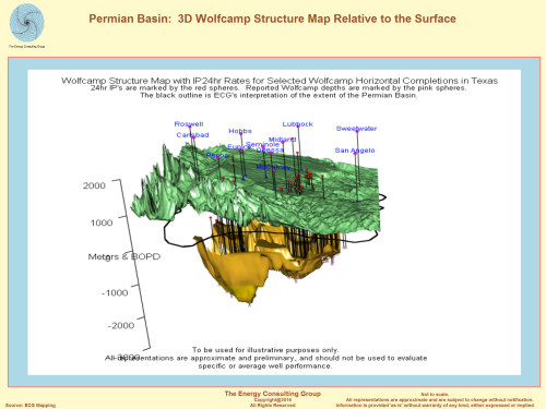 |
Permian Basin: 3D Wolfcamp Structure Map Relative to Reported Rig
Activity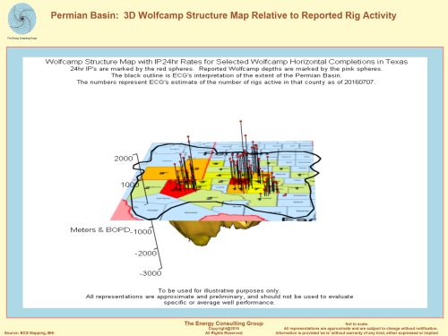 |
|
This second 3D map presents the
top of Wolfcamp structure relative to corresponding surface
elevations. |
|
3D map of the top of the Wolfcamp structure and rig activity. It
appears that the greatest levels of activity
roughly correspond to the deepest depths of the Wolfcamp. |